For this activity you will be using Google Maps satellite view to investigate the features of the ocean floor. Read about each feature and then explore the locations provided in Google Maps.
Webquest Part 2 - Ocean Floor Meets Google
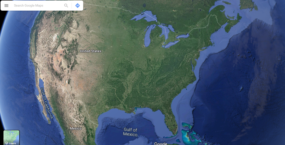
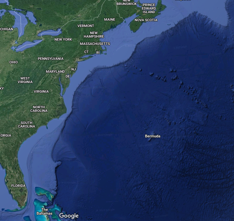
Look at the continental shelf on the east coast of the United States. (Georgia is on the East coast) Notice the difference in colors as it will help you answer the questions. The light blue areas along the coast indicate shallower water and the darker blue areas indicate deeper water.
13. What state on the EAST coast, has the narrowest (slimmest area) continental shelf?
14. What state on the EAST coast, has the widest (biggest area) continental shelf?
13. What state on the EAST coast, has the narrowest (slimmest area) continental shelf?
14. What state on the EAST coast, has the widest (biggest area) continental shelf?
|
|
The Great Barrier Reef link shows a section of the reef at the edge of the continental shelf. Take a few minutes to move around in Google Earth and explore the reef to see the different signs of life.
15. What signs of life do you see?
15. What signs of life do you see?
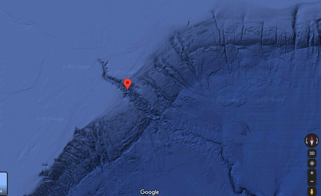
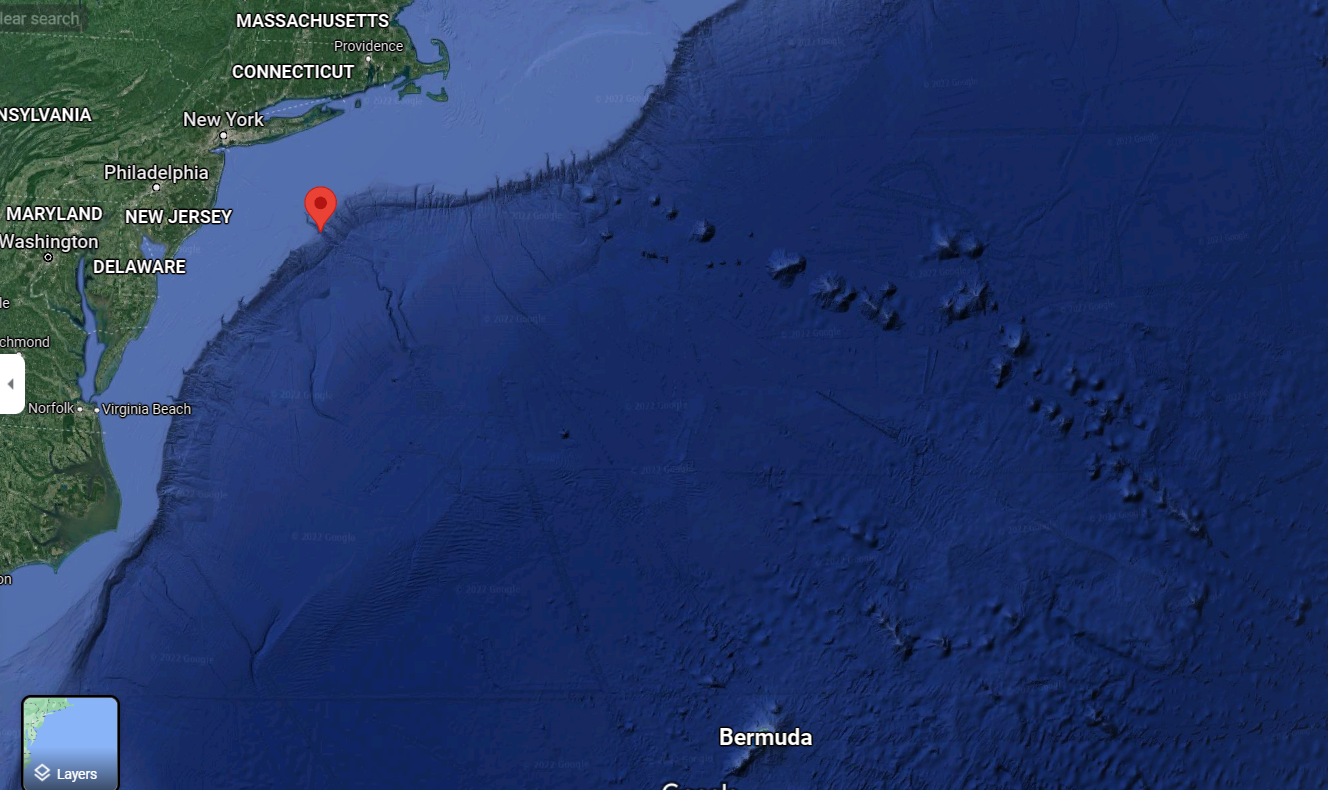
Submarine Canyon:
These are canyons that were formed a LONG TIME ago by erosion when water drained into ancient seas. Use the button below to see the Hudson Canyon. If you zoom out and follow the continental slope you will see other canyons such as the Washington Canyon and Baltimore Canyon. The Hudson Canyon, is identifiable as it is the largest submarine canyon on the East Coast.
16. The Hudson Canyon (submarine canyon) is located east of New Jersey and New York; it cuts into the continental shelf and what other ocean floor feature?
|
|
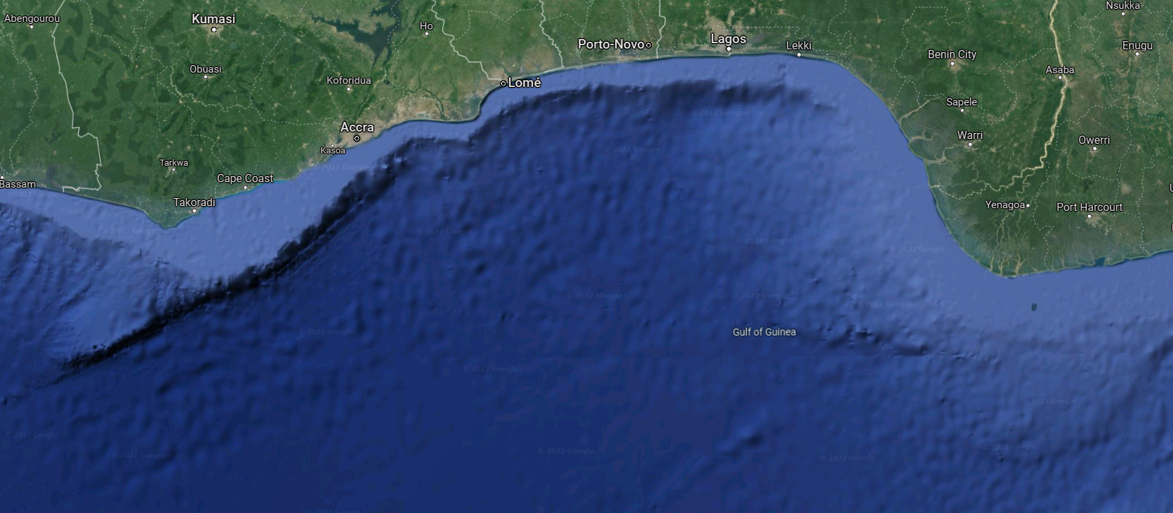
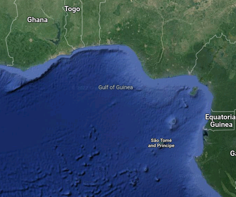
Compare the slope near the Hudson Canyon (pictured above) with the slope of the Gulf of Guinea (off the coast of Africa). Notice the difference in colors as it will help you answer the questions. Also think about the correlation between the color differences and the slope angle to help you explain the below question. The darker the blue the more steep the continental slope (the dropoff) is, and the lighter the blue is means it is more gradual (slowly sloping).
17. Look at the Gulf of Guinea and compare it to the Hudson Canyon. The Hudson Canyon has a gradual slope down to the abyssal plain but how is the Gulf of Guinea different in terms of slope? (hint: slope is not the same on all sides of the Gulf of Guinea)
17. Look at the Gulf of Guinea and compare it to the Hudson Canyon. The Hudson Canyon has a gradual slope down to the abyssal plain but how is the Gulf of Guinea different in terms of slope? (hint: slope is not the same on all sides of the Gulf of Guinea)
|
|
The abyssal plain is mostly flat, however, there are some features scattered throughout. [Hint: You may need to go back to the Ocean Floor features page if you can't remember the names. :) ]
Move around the Atlantic Ocean's abyssal plain (from the east coast of the United States to the west coast of Africa) and notice the ocean floor features shown on Google Earth.
18. What all ocean floor features do you see on the Atlantic’s abyssal plain? (you should list at least 2)
Move around the Atlantic Ocean's abyssal plain (from the east coast of the United States to the west coast of Africa) and notice the ocean floor features shown on Google Earth.
18. What all ocean floor features do you see on the Atlantic’s abyssal plain? (you should list at least 2)
The Mid-Atlantic Ridge formed at the edges of the North American and Eurasian Plates.
Click the button below and follow it up and down the center of the Atlantic ocean to answer the next few questions.
The Mid-Atlantic Ridge formed at the edges of the North American and Eurasian Plates.
19. What ocean is the beginning point of the Mid-Atlantic Ridge? What ocean is the ending point of the Mid-Atlantic Ridge? (hint: Follow it down south, where does it end? ) Begins at _____ Ocean. ends at _____ ocean
The Mid-Atlantic Ridge is located mostly underwater, however, one portion has enough elevation to rise above the surface of the ocean.
20. What country is rising up above the surface of the ocean, on the Mid-Atlantic Ridge? (as you travel north on the ridge)
Webquest Part 3 - Ocean Floor Meets Google
An ocean trench is a long but narrow depression in the sea floor. They are often located along convergent plate boundaries, where two plates move towards each other and one plate is forced under the other.
Look at all three examples of an ocean trench with button map points for the Mariana Trench, Puerto Rico Trench, and Aleutian Trench.
21. In addition to a very deep trench, what else (above water) do all three trenches have near them? *Zoom out a bit and what do you notice?
Volcanic islands can form near a plate boundary as a result of tectonic activity. When two tectonic plates collide and one slides under the other, volcanoes on the sea floor can form. Over time those volcanoes build up, some eventually rising above the surface of the ocean. Volcanoes that form near a tectonic plate boundary often form a semi-circular shaped island chain known as a volcanic island arc.
Underwater volcanoes can also form over abnormally hot mantle locations called hot spots. Hot spots can occur at plate boundaries or in the middle of a tectonic plate. As a tectonic plate slowly drifts over a hot spot, a chain of islands is formed.
Look at the volcanic island examples below linked in the buttons. They are the Hawaiian Islands, Aleutian Islands, Kuril Islands, and Tuamotu Islands. For the next questions you must be able to identify them as island arcs or hot spots. You can look above to re-read about the differences between an island arc and a hot spot above, in order to answer this correctly.
22. What is a volcanic island arc?
23. Which of these islands (the Hawaiian Islands, Aleutian Islands, Kuril Islands, and Tuamotu Islands) are examples of volcanic island arcs?
24. What is a volcanic island hot spot?
25. Which of these islands (the Hawaiian Islands, Aleutian Islands, Kuril Islands, and Tuamotu Islands) are examples of a volcanic island hot spot?
Check out the diagram of the ocean floor and make sure you are familiar with each feature and can correctly identify them.
